 By codebitmatrix@gmail.com
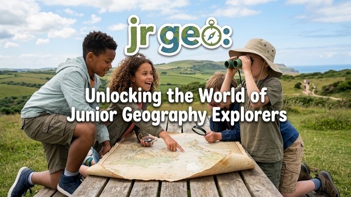
In an age where digital screens dominate childhood attention and global awareness is more critical than ever, the concept of “jr geo” emerges as a beacon of curiosity and foundational learning. But what exactly is jr geo? At its core, it represents the introduction of geographical principles, spatial thinking, and earth sciences to young learners—typically children between the ages of 5 and 12. It is the gateway discipline that transforms a child’s natural wonder about mountains, rivers, animals, and faraway cities into structured knowledge about the planet they inhabit. This article delves into the importance, methods, and long-term benefits of nurturing a junior geographer, providing parents and educators with a comprehensive guide to making geography a thrilling adventure rather than a tedious school subject.
The Fundamental Importance of Early Geographic Education
Geography is often misunderstood as merely memorizing capital cities or drawing borders on a map. However, jr geo is far more expansive and vital. For a child, understanding geography means developing a sense of place, scale, and connection. When a five-year-old traces a route from their home to the school bus stop, they are engaging in spatial reasoning. Then a seven-year-old asks why it snows in some places and not in others, they are thinking like a climatologist. It a nine-year-old sorts pictures of animals by continent, they are building biogeographic knowledge.
Research in early childhood education consistently shows that spatial thinking—the ability to understand and reason about the arrangement of objects and places in space—is a strong predictor of later success in science, technology, engineering, and mathematics (STEM) fields. jr geo lays the groundwork for this cognitive skill. Moreover, in an increasingly interconnected world, children who grow up with a solid geographic foundation are more likely to become tolerant, informed, and empathetic global citizens. They learn that people live differently across the globe not because one culture is superior to another, but because of variations in climate, resources, history, and topography.
The modern challenge is that geography has been sidelined in many elementary curricula, squeezed out by an intense focus on literacy and numeracy. Consequently, it falls to parents, caregivers, and passionate educators to champion jr geo at home and in after-school programs. The good news is that young children are natural geographers. They love collecting rocks, examining leaves, building sandcastles (which is rudimentary geology and coastal geography), and staring at maps of theme parks or treasure hunts. The key is to channel this innate curiosity intentionally.
Core Components of a Junior Geography Curriculum
A robust jr geo program does not mean handing a preschooler a college textbook on plate tectonics. Instead, it breaks down complex ideas into tangible, age-appropriate concepts. Here are the five pillars that support effective early geography learning:
-
Spatial Awareness and Mapping: Before a child can read a world map, they must understand their immediate environment. This starts with simple activities: drawing a map of their bedroom, hiding a toy and giving directional clues (“three steps north, two steps west”), or using a compass in the backyard. The language of geography—near, far, left, right, above, below, cardinal directions—should become part of daily conversation.
-
Physical Geography (The Natural World): This is the “earth” part of jr geo. Children learn about landforms (mountains, valleys, plains, islands), bodies of water (oceans, lakes, rivers, ponds), weather patterns, and the four seasons. Hands-on activities are best: creating a volcano with baking soda and vinegar, making a raincloud in a jar, or building a diorama of a desert versus a rainforest.
-
Human Geography (Cultures and Communities): Here, young explorers discover that geography is not just about rocks and rivers—it is about people. This includes studying how people live in different parts of the world: their homes (igloos, stilt houses, adobe dwellings), their food, their clothing, their festivals, and their transportation. A jr geo unit might involve a “passport day” where children sample a simple snack from a different country and learn one word in a new language.
-
Political Geography (Basic Borders): At a junior level, this means recognizing that the world is divided into countries and that these countries have flags, capitals, and unique shapes. However, the goal is not rote memorization but recognition. Simple puzzles of the United States or the continents, coloring maps where each country is a different color, and singing songs about the seven continents are effective strategies.
-
Environmental Stewardship: A modern addition to jr geo is the concept of human impact on the planet. Children can learn about recycling, pollution in oceans, endangered species, and why it is important to conserve water and electricity. This pillar turns geography into action, empowering children to feel that they can help protect the Earth.
Practical Activities and Games for Junior Geographers
Theory is meaningless without engagement. The most successful jr geo instruction is play-based and multisensory. Below are ten proven activities that parents and teachers can implement immediately, with minimal preparation and cost.
Activity 1: The Living Room Map
Spread a large piece of butcher paper on the floor. Ask the child to draw the layout of the living room, including furniture, doors, and windows. Then, hide a small toy and mark an “X” on the map. The child must use the map to find the toy. This teaches scale, symbols, and perspective.
Activity 2: Continent Hopscotch
Draw a large hopscotch grid on the driveway or with chalk on a carpet, but label each square with a continent name instead of numbers. When the child lands on a square, they must name one country from that continent or one animal that lives there.
Activity 3: Weather Watcher Journal
For one week, the child records the daily weather (sunny, cloudy, rainy, snowy) on a simple chart. Then, they compare it to a weather map from another city (e.g., a friend or relative who lives far away). Discussion point: Why is it different? This introduces climate zones.
Activity 4: Treasure Hunt with Coordinates
Create a simple grid (A, B, C along the top; 1, 2, 3 down the side) on a backyard or park map. Hide treasures at specific coordinates (e.g., “B2”). The child learns to read grid references, a foundational skill for GPS and topographic maps.
Activity 5: Postcard Swap
Connect with another family or classroom in a different state or country (online homeschooling groups are excellent for this). Exchange postcards or letters describing local geography, landmarks, and daily life. The tangible arrival of a physical postcard is thrilling in a digital age.
Activity 6: Edible Landforms
Use play dough, modeling clay, or even food items (mashed potatoes for mountains, blue icing for lakes, green sprinkles for forests) to build a three-dimensional landscape. Label each landform with a toothpick flag. Then, eat the creation—a memorable multisensory experience.
Activity 7: Flag Designer
Give the child a blank piece of paper. Explain that flags often use symbols from a country’s geography (e.g., the maple leaf for Canada’s forests, the sun for Argentina’s climate). Ask them to design a flag for their own imaginary country, including at least two geographic features (e.g., a mountain and a river).
Digital Tools and Technology for Jr Geo
While hands-on activities are irreplaceable, thoughtful use of technology can greatly enhance jr geo learning. The key is to use screens actively, not passively. Instead of watching a video about deserts, the child should be interacting with the content.
Google Earth (Free): The most powerful tool in the junior geographer’s arsenal. A child can start at their own house (type in the address), zoom out to see the neighborhood, then the city, then the state, then the country, then the continent, and finally the entire planet. Use the “voyager” feature for guided tours of national parks, volcanoes, and world wonders. Ask questions like, “Can you find a river near our house?” or “What shape are the fields in that farming region?”
Kids World Maps (Apps): Applications like “Barefoot World Atlas” (iOS) allow children to tap on any region of a 3D globe and hear sounds, see animal photographs, and learn short facts. “Stack the Countries” (Android/iOS) gamifies political geography with a stacking physics puzzle.
Online Puzzles and Quizzes: Websites like Seterra offer free, simple map quizzes that are not timed for young learners. Start with “Identify the 7 Continents” and progress slowly. Always pair a quiz with a real-world story or image from that place.
Age-Appropriate YouTube Channels: Channels such as “SciShow Kids” and “Nat Geo Kids” produce short (3-5 minute) videos explaining geographic phenomena like “How do hurricanes form?” or “Why do rivers curve?” Watch together and pause to discuss.
The Role of Books and Atlases
No screen can replace the tactile pleasure of a large, colorful children’s atlas. When selecting jr geo reading materials, look for books that emphasize visual appeal and short, digestible facts rather than dense paragraphs. Excellent choices include the “National Geographic Kids World Atlas” (now in its 6th edition for young readers), which is filled with photographs, maps, and “fun facts” boxes. Another gem is “Maps” by Aleksandra Mizielinska and Daniel Mizielinska—a giant, illustrated book showing each country’s culture, animals, landmarks, and foods in a whimsical, detailed style.
For bedtime reading, consider storybooks with a geographic twist. “How to Make an Apple Pie and See the World” by Marjorie Priceman takes the reader on a journey to collect ingredients from Italy, France, Sri Lanka, and more. “Me on the Map” by Joan Sweeney is a classic that perfectly illustrates the concept of nested scales—from a room to a house to a street to a city to a country to the world.
Overcoming Common Obstacles in Teaching Jr Geo
Many adults feel ill-equipped to teach geography. They may confess, “I was never good at geography myself” or “I don’t remember where countries are.” This is an opportunity, not a barrier. Learning alongside a child is a powerful bonding experience. When a parent says, “I’m not sure—let’s look it up together on the globe,” they are modeling lifelong learning and humility. The goal of jr geo is not to create a child who can recite all 195 countries by age eight; it is to foster a habit of curiosity about place.
Another obstacle is the perception that geography is irrelevant to “real life.” Counter this by pointing out geography in everyday actions. If you navigate a new route in the car, you are using geography. When you check the weather forecast before a picnic, you are using meteorology (a branch of geography). and you read a news story about a drought in Africa or a flood in Asia, understanding where those places are and why the climate behaves that way is essential.
Long-Term Benefits: Beyond the Classroom
Children who engage with jr geo develop cognitive and emotional skills that serve them for a lifetime. The most obvious benefit is a stronger performance in social studies and science in later grades. But the less obvious benefits are equally powerful.
First, improved reading comprehension: Many stories rely on setting. A child who understands the difference between a tundra and a jungle will better visualize the challenges faced by characters in “The Snowy Day” versus “The Jungle Book.” Second, critical thinking: Geography teaches systems thinking. A child learns that a river is not just a line on a map; it is a water source, a transportation route, a habitat for fish, and a potential flood risk. Third, memory and mnemonics: Creating mental maps is an exercise in spatial memory, which strengthens overall memory capacity. Finally, global empathy: The single most important outcome of jr geo is the death of “othering.” When a child learns that a child their age in Mongolia lives in a ger (yurt) because of the nomadic herding tradition suited to the steppe climate, they understand that different does not mean strange. Different is adaptation. Different is beautiful.
Creating a Jr Geo Learning Environment at Home
You do not need a dedicated classroom to foster a junior geographer. A small corner of a room can become a “geography center.” Place a globe or a world map on an easel. Keep a basket with blank paper, colored pencils, a ruler, and a compass. Pin up a large world map. Use a dry-erase marker. Circle places from the news or stories. Rotate a “country of the week.” Print pictures of its landscape, animals, and people. Cook a simple recipe. Play a folk song at dinner.
Additionally, travel—even local travel—is living geography. A trip to a nearby state park becomes a lesson in erosion. A visit to a different neighborhood becomes a lesson in urban planning (why are the streets laid out like that? Why are there more parks here?). A family vacation to the coast versus the mountains highlights contrasting physical geographies.
Conclusion: The Journey of a Thousand Miles
The famous Chinese philosopher Lao Tzu wrote, “A journey of a thousand miles begins with a single step.” For the young learner, that single step is jr geo. It is the recognition that the world is not a flat, abstract picture but a vibrant, diverse, and interconnected sphere.
When we introduce mapping, landforms, cultures, and environmental care to young learners, we aren’t just teaching facts. We are raising confident children.
They will navigate with curiosity. They will care deeply for this planet. Whether through a backyard compass hunt, a volcano experiment, or a bedtime story about faraway markets—the world is waiting. And with jr geo, every child can become an explorer. So unroll that map, spin that globe, and take the first step today. The adventure is just beginning.